
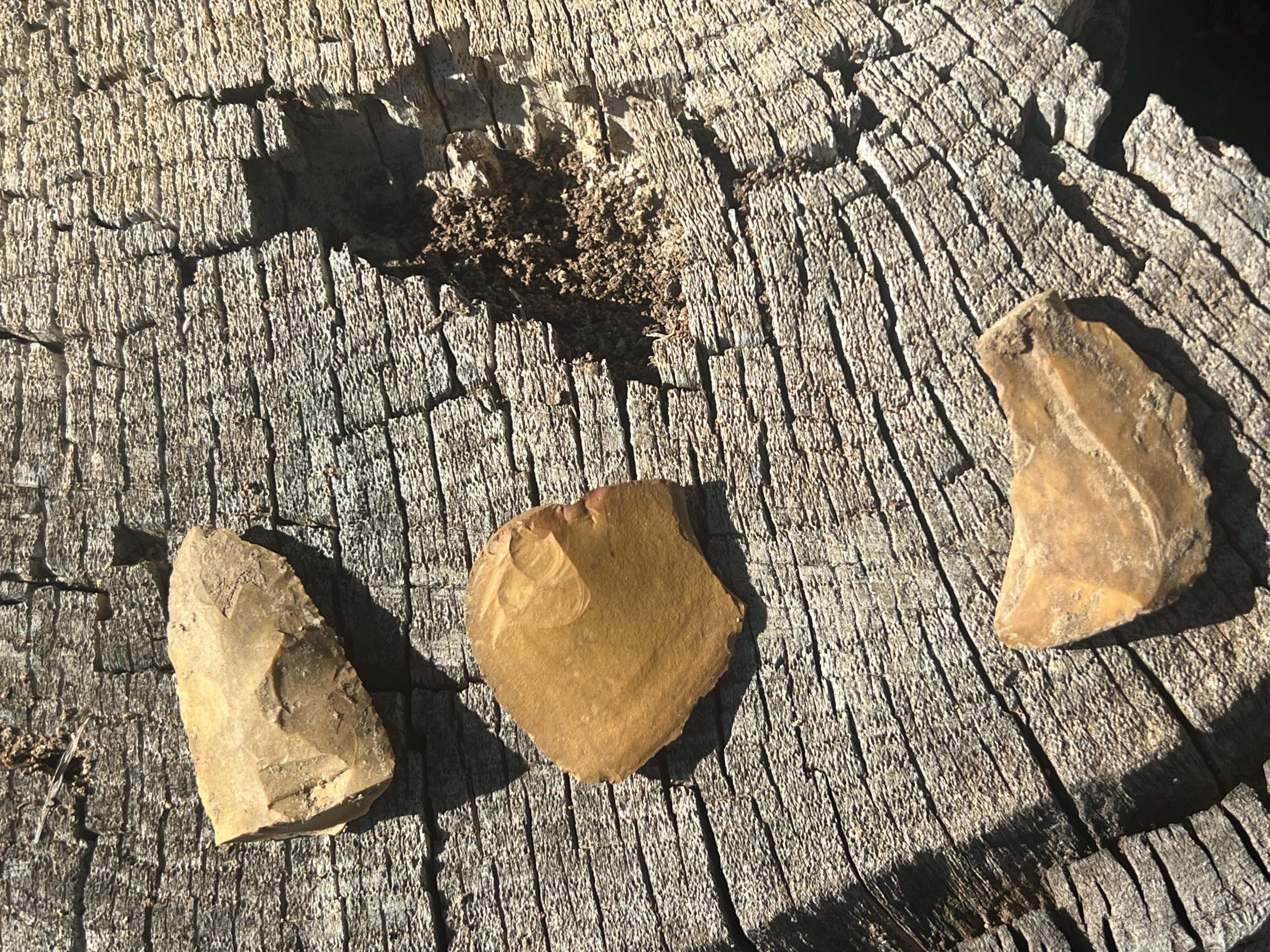
The distal end of a Late Archaic projectile point and two worked flakes were found on a slight rise northeast of the main mound at Spokane.
Photo Credit: Jessica Crawford / TAC
The Conservancy’s latest acquisition in Mississippi is in the southwestern part of the state in Adams County near Natchez. Spokane Mound was first recorded in the 1930s by archaeologist James A. Ford as a single mound site. At the time, Ford was a student at Louisiana State University, but he would go on to become one of the most important and well-known pioneers in American archaeology, credited with developing the ceramic seriation technique. He was an early president of the Southeastern Archaeological Conference and excavated some of the largest earthen mounds in the Southeast.
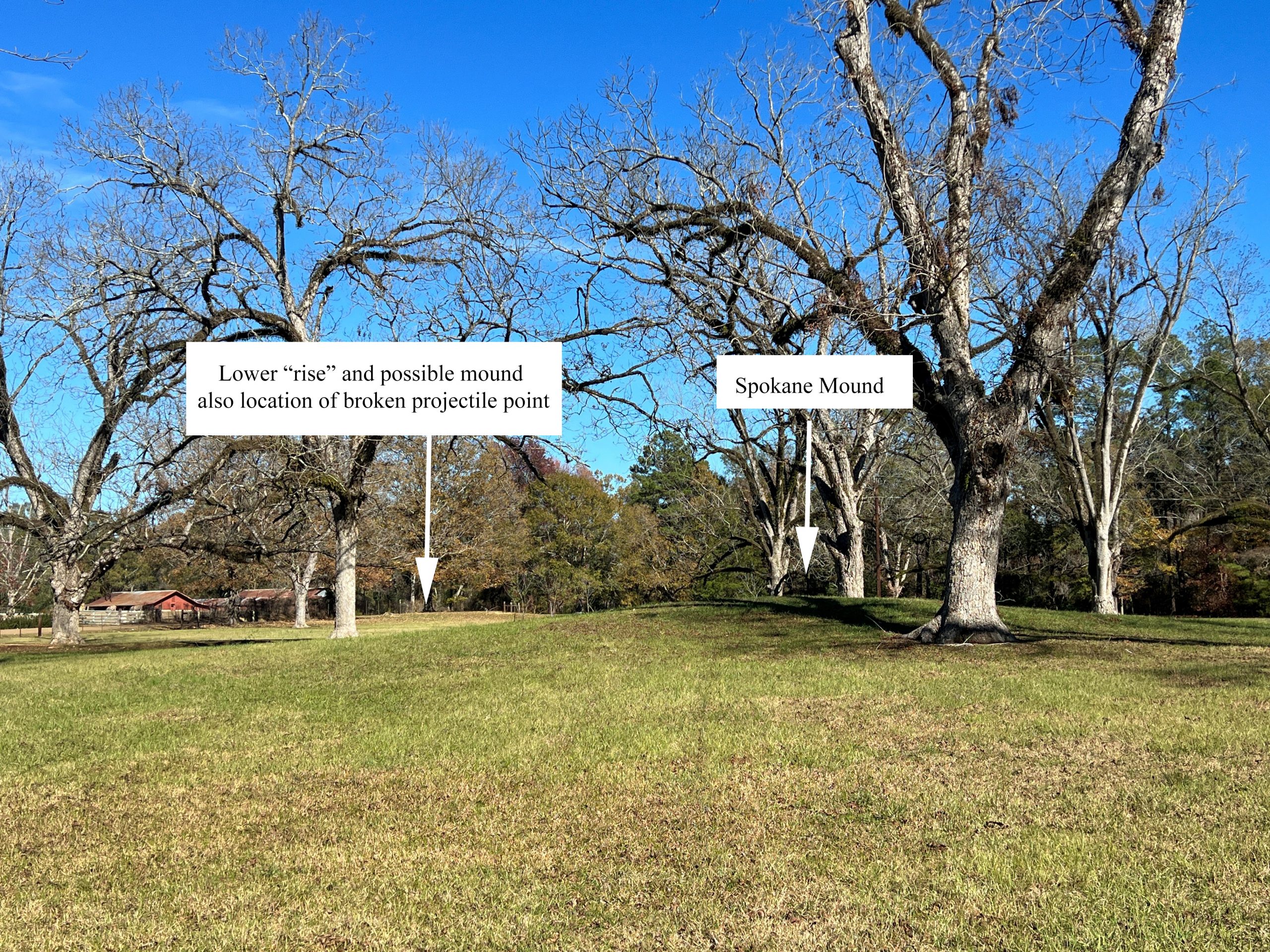
The Spokane Mound site was located on what was then called O’Kelly Plantation and was given the name O’Kelly Mound. Somehow the site did not make it to updated site files and the small burial mound was recorded again in 1974 as Spokane Mound, named after the road on which it is located. Impacted by years of agriculture, it now stands about 5 feet in height and the base is about 65 feet by 36 feet.
Little professional work has been done at the site. Surface collections have yielded pottery that suggest the mound could be a Late Woodland mound attributed to the Coles Creek Culture, dating to approximately A.D. 800-1100. If Spokane Mound is a Coles Creek mound site, it was likely a ceremonial center with a plaza and included other mounds. Due to past disturbances of the mound, it is known that Spokane Mound contains burials. A single mound site with burials fits better with earlier Middle Woodland cultures dating to approximately A.D. 100, but to date, no Middle Woodland pottery has been found at the site.
Using LiDAR, archaeologist Shawn Lambert with Mississippi State University noticed what may be another mound at the site. This area could be just the “toe” of a ridge which is visible rising into the bluffs across the road, or perhaps it is another mound. Interestingly, the surface of the ridge yielded the distal end of a Late Archaic (circa 4000-1000 B.C.) projectile point, indicating an occupation even earlier than the Middle or Late Woodland period. Further research at the site would be needed to determine if there is more than one mound, and during which time periods the area was inhabited.
—Jessica Crawford, Southeast Regional Director